 OGReNet Lesson Recipes
written by:
Cam Tsujita
Department of Earth Sciences,
The University of Western Ontario
Background:
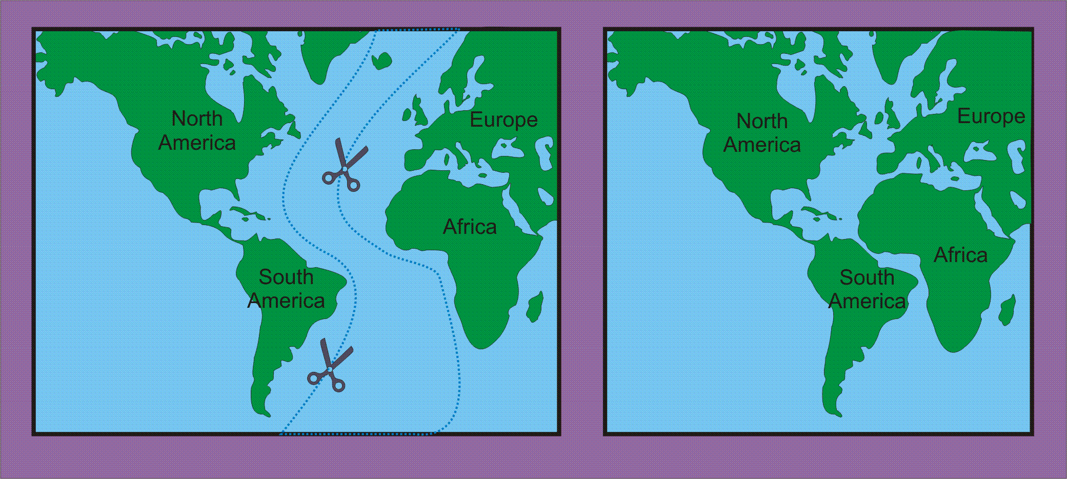
One of the first pieces of evidence that suggested
to scientists that the configuration of the Earth's tectonic plates was
not always as it is today is that some of the continents which are now
separated can be fitted together like a jigsaw puzzle. For example,
if one were to close the Atlantic Ocean, the western bulge of Africa fits
nicely into the embayment on eastern side of the Americas North stretching
from Nova Scotia to Brazil. Cut out the Atlantic Ocean from the diagram
below and see how well North and South America fit with Europe and Africa.
To view these maps at full-size, right click on the image and click on "View Image". To save the image for later printing at full size, right click on image and select "Save Image As...".
Other evidence suggesting that continents have wandered includes the distribution of ancient glacial deposits and ice scour structures (sometimes indicating ice flow direction) and distribution of continental fossils such as the fern Glossopteris and the lizard Mesosaurus in the southern continents of the Earth. In this exercise, the use of geological evidence in the reconstruction of continental configurations in the past is demonstrated.
Materials Needed for Activity:
1. Diagrams provided (click here for
fossil and ice sheet maps)
2. Scissors
Procedure:
Cut our the continents from the diagrams provided
and fit them together to form a single land mass based on evidence provided
by fossils and ice flow indicators (note that the glaciation was centred
on the south pole and spread outward from that point).
Students can cut and reassemble the continents themselves, or the teacher
can print the diagrams on transparencies and demonstrate the "reconstruction"
on an overhead projector.
Observations:
Both fossil and glacial data provide convincing
evidence that the southern continents were once connected but later drifted
apart to produce the continental configuration we are familiar with today.
Note that it would have been impossible for such evidence to exist on now
widely separated continents if these continents were not, at one time,
connected (click here for the solution
to the puzzle).
Additional comments:
About 200 million years ago, the southern continents
formed the supercontinent "Gondwanaland." Shortly before this time,
Gondwanaland was attached to an even larger supercontinent called "Pangaea"
that included the southern and northern continents of present-day Earth.
![]()

![]()