 OGReNet Lesson
Recipes
OGReNet Lesson
Recipes
Worms-Eye and Birds-Eye Views of Soil Texture
written by:
Heather Gingerich,
Department of Earth Sciences, The University of Western Ontario
Designation: Ontario Curriculum: Science and Technology
Earth and Space Systems: Grade 3 Soils in the Environment
Specific Expectations Addressed:
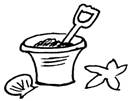
Understanding Basic Concepts - describe, using their observations, the differences between sand, clay, humus, and other soil components (e.g., texture, smell, malleability), and compare and describe soil samples from different locations (e.g., school yard, forest, marsh, beach).
Developing Skills of Inquiry, Design, and Communication record relevant observations, findings, and measurements, using written language, charts, and drawings (e.g., create a tally chart to record the water absorption of different earth materials).
Relating Science and Technology to the World Outside School recognize the importance of understanding different types of soil and their characteristics (e.g., enables people to determine which crops can be grown in a particular area; enables gardeners and farmers to improve plant growth).
Background:
Soils are a functioning part of our ecosystem, controlling the flow of energy, water, and nutrients. While soils are an important resource for all of humankind, not all soils are created equally. They are made up of different components, or ingredients, that give each soil type certain characteristics that make them very suitable for one purpose (e.g., like growing food) but not so appropriate for others (e.g., like lining water wells and landfill sites). By giving the students a worms-eye view of soils, this module will clearly illustrate how the physical property of Soil Texture affects the flow of water and nutrients or contaminants through the soil.
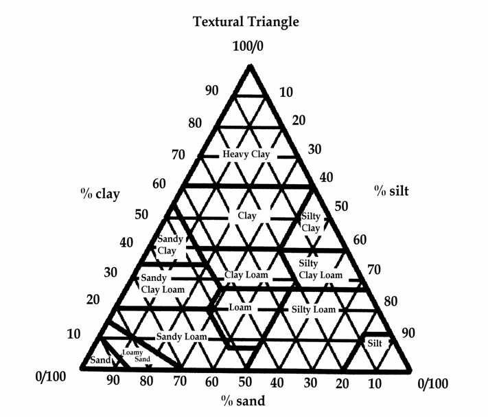
Texture refers to the relative proportions of the various sized particles in the soil. Texture does not consider organic matter or humus; only the proportion of sand, silt, and clay, which are inorganic or mineral constituents derived from rock or formed as precipitates. The texture of a soil is a characteristic inherited from the parent material or rock type from which the soil has formed, usually by long periods of weathering. Earth scientists use a 3-way chart called the Textural Triangle to determine soil type, which is based on the proportion or percentage of each of the three main particle sizes; Sand, Silt, and Clay. Because sand, silt, and clay differ substantially with respect to size, shape, and pore size, the property of texture will play a large role in determining how well water and other things can flow through a soil.
A texture class that is very desirable for agriculture is loam. Loam contains nearly equal amounts of sand, silt, and clay, combining all the best properties of the three main particle sizes. For example, the sand component provides plants with enough water drainage to allow Oxygen and other gases to get to the roots, the silt component helps retain the water needed for the plants use, and the clay component provides the plant with the mineral nutrients it needs to grow. Most food crops do very well in a loamy soil. If a soil is severely deficient in any one of the three main particle sizes, farmers and gardeners may decide to amend or add to the soil.
By understanding how well water (and energy and nutrients or contaminants) will be transported through a certain type of soil, we can make wise decisions about how to best protect and manage our valuable soil resource.
This activity may be done all at once or broken into three parts, depending on time allowances.
Materials Needed For Activity:
Procedure:
Part 1 Water Transport
Remove the labels and the screw caps from the plastic beverage bottles. Cut the bottles all the way around, about 1/3 of the way down from the neck. Stretch a 2x 2 square of nylon panty hose over the neck of each bottle and secure with an elastic band. Invert the top 1/3 of the bottle into the bottom 2/3s so that the neck is pointed down and the nylon filter sits a few inches from the bottom of the bottle. The top 1/3 should rest securely atop the bottom 2/3s of the bottle if you have used the kind of beverage bottles that are slightly waisted in the middle.
Fill the top 1/3 of one bottle with 100 x ½ marbles; this represents Sand.
Fill the top of the second bottle with 250 ml of uncooked, short-grained rice that you have broken up slightly (i.e., made irregular particles) with hammer, mallet, or mortar and pestle; this represents Silt.
Fill top of the third bottle with tightly packed (horizontally) squares of newsprint; this represents Clay. Be sure the newsprint squares reach, and perhaps even slightly climb, the sides of the bottle, and that you have enough room at the top for 400 ml of liquid without spilling over. If not, remove some of the material.
Set the display where it is clearly visible to the students but out of easy reach because the apparatus may be a little unstable.
Distribute the Soil Particle Size Chart and Experimental Notes Sheet Water Transport (provided) to the students and give your introductory talk on soil texture (see Background). Have the students fill in the Soil Particle Size Chart and draw what they see in each bottle, paying particular attention to particle size, particle shape, and pore (i.e. the empty spaces between the particles) size and shape.
NB The 1x 1 squares of newsprint are meant to represent Clay which has the smallest particle size, and yet the pieces of newsprint are larger than the marbles. Point out to the students that paper is composed of tiny fibres that lay flat and are woven close together. These individual fibres are so small that you can only see them with a magnifying glass or microscope, much like individual clay particles. A special property of clay is that the individual particles prefer to connect to each other in flat sheets, hence the paper analogy.
Fill the measuring cup with 400 ml of water and appoint a Time Keeper. Start the clock and slowly pour the water over the Clay. Record how long it takes for the water to completely filter through the apparatus or until water is dripping only infrequently. Remove the top of the apparatus and measure the volume of filtrate collected in the bottom of the apparatus in the measuring cup. Record your observations and results in the Experimental Notes, and discard the water. Repeat the procedure with the Silt and the Sand. Your Time Keeper will have to have excellent reflexes when dealing with the marbles!
Now that everything is moist, repeat the procedure. Record your results in the Experimental Notes. Be sure to note any differences between Wet and Dry conditions.
The demonstration phase of Part 1 - Water Transport is now complete. Discard the water down the sink or in the collection pail and put the apparatus someplace safe and out of reach for later use, or continue with Part 2 - Contaminant Transport.
Part 2 Contaminant Transport
A common belief is that soil filters out all contaminants. You will now test this hypothesis using your apparatus. You will not need your Time Keeper for this exercise. Distribute the Experimental Notes Sheet Contaminant Transport (provided) to the students.
Lets begin with the largest kind of contaminant, Bacteria and Large Biologic Organisms. Place 1/3 of the pieces of cut-up sponge in 200 ml of water and pour onto the Clay. Repeat the procedure with the Silt and the Sand (i.e. using 3 x 200 ml of water). Record your observations. Remove the pieces of sponge and discard the water.
Now lets try Particulates. Place 25 ml (about 2 tablespoons) of dried unground spice (e.g., rosemary leaves) into 200 ml of water. Pour the 200 ml mixture onto each of the 3 soil types (i.e. using 3 x 200 ml of water). Record your observations, discard the water, scoop off or rinse out the spices.
Next are Viruses and Small Biologic Organisms. Stir 25 ml of dried, ground spice (e.g. cinnamon powder) into 200 ml of water. Pour the 200 ml mixture onto each of the 3 soil types (i.e. using 3 x 200 ml of water). Carefully remove the elastic band around the neck of the filter and check for residue. Keep the screw-on cap handy so that the rice (Silt) and marbles (Sand) dont fall out while you are checking the filter. Rinse off the nylon filter under water and replace. Record your observations, discard the water, and scoop off or rinse out the spices.
For the sake of tidiness, well do the smallest-sized contaminants next; Dissolved Contaminants (e.g., salts, metals and minerals, water-soluble chemicals). Mix up the Kool-Aid powder or food colouring in 600 ml of water. Pour 200 ml onto each soil type, record your observations, and discard the water.
Lastly, well experiment with Non-water Soluble Contaminants (e.g., oils, gasoline, and non-water-soluble chemicals). Add 100 ml of cooking oil to 100 ml of water. Pour onto the Clay. Remove the top of the apparatus and measure the volume of the filtrate, making special note of the volume of water and the volume of oil. Repeat the procedure for the Silt and the Sand (i.e. using 3 x 100 ml of oil and 100 ml of water).
Discard the newsprint and rice in the garbage, wash off the marbles with dish detergent, and recycle the apparatus. The pail of discharge may be rinsed down the sink or flushed down the toilet.
Part 3 Land Use
Distribute the Textural Triangle Chart, Land Use Hints Sheet and Land Use Map (provided) to the students. You may elect to have the students draw their own Land Use symbols on the map or cut and paste from a copy of the Land Use Symbols Sheet provided.
This part of the activity illustrates how deciding how to put the land that is available to us to best use is very important and can have long-term, and sometimes irreversible, effects.
For example, fields that are cleared for agriculture are usually very productive for the first few years, mostly because the dead plant matter and forest litter (e.g. fallen leaves, grasses, etc.) is composted naturally to form Humus or Organic Matter, which is full of vital nutrients needed for crop growth. But without the forest root systems to hold everything in place, the thin but fertile top layer of soil, called Topsoil, is usually eroded away after a few seasons. The roots of trees and grasses and wet-land plants help to hold even the smallest particles in place, and are excellent prevention against landslides and soil erosion by wind or water. This is why there is so much concern over clearing of the Amazon Rainforest for cattle pasture or growing soybeans. Also, the plants in conservation areas can also chemically block the flow of contaminants through the soil and into surface or groundwater resources. Putting certain plants between a potential source of contamination and a waterway is called creating a Buffer Zone or a small Green Belt, and is a very effective, attractive but inexpensive way to protect a stream or a river from agricultural, urban or industrial pollution.
Sometimes, soils that are very suitable for agriculture are found in places where people would like to build their houses or locate their office buildings and parking lots. Once the organic matter-rich topsoil is removed or compacted by construction, the area can probably never be used for large-scale agriculture again. Remember that the pioneers had to travel by water most of the time, and so they also tended to establish their settlements near waterways. You can see evidence of this by looking at a map of Canada even now most of the oldest and largest cities are located near the water. Because water is so important to soil development, these urban areas are also where the best soils for agriculture are found. Because industries want to keep the transportation costs of their goods to market as low as possible, they also want to locate their factories near where the people are. This creates the potential for much of conflict between the Urban, Agricultural, and Industrial parts of our societies, and why governments spend so much time and money trying to decide What Should Go Where?.
Part 3 of this activity allows students to try their hand at appropriate Land Use Planning, based on an analysis of Soil Texture. There is probably no single Right Answer to these types of problems, but working through the Land Use Hints Sheet first should point you in the right direction.
Observations:
Students who have taken a good look at Soil Texture from several different perspectives (i.e. Cross Section and Plan View, short- and long-term, experimental and practical) soon realize that not all dirt is created equal. Soil is an important part of the biosphere in which we live, and while it is almost impossible to assign a monetary value to it, only through gaining an understanding of its physical and chemical characteristics can we ever hope to manage it properly.
Part 1 of this activity illustrates how and why water is transported through or absorbed by different soil types. Soil particle shape and size determine pore shape and size and connectedness, which in turn determines how easily water molecules can move around.
Part 2 shows why it is a dangerous practice to dispose of contaminants by simply pouring them on the ground in the hopes they will simply disappear. While some contaminants are effectively filtered out of water, others are not. Again, this has mostly to do with particle-pore shape and size.
Part 3 demonstrates just how challenging it is to use land properly and this exercise only really considers soil type! There are many ways to use soil, the big question is deciding which is the best way to use this valuable and virtually non-renewable resource.
Handout: Land Use Hints Sheet
OGReNet SCHOOL OF LAND USE PLANNING
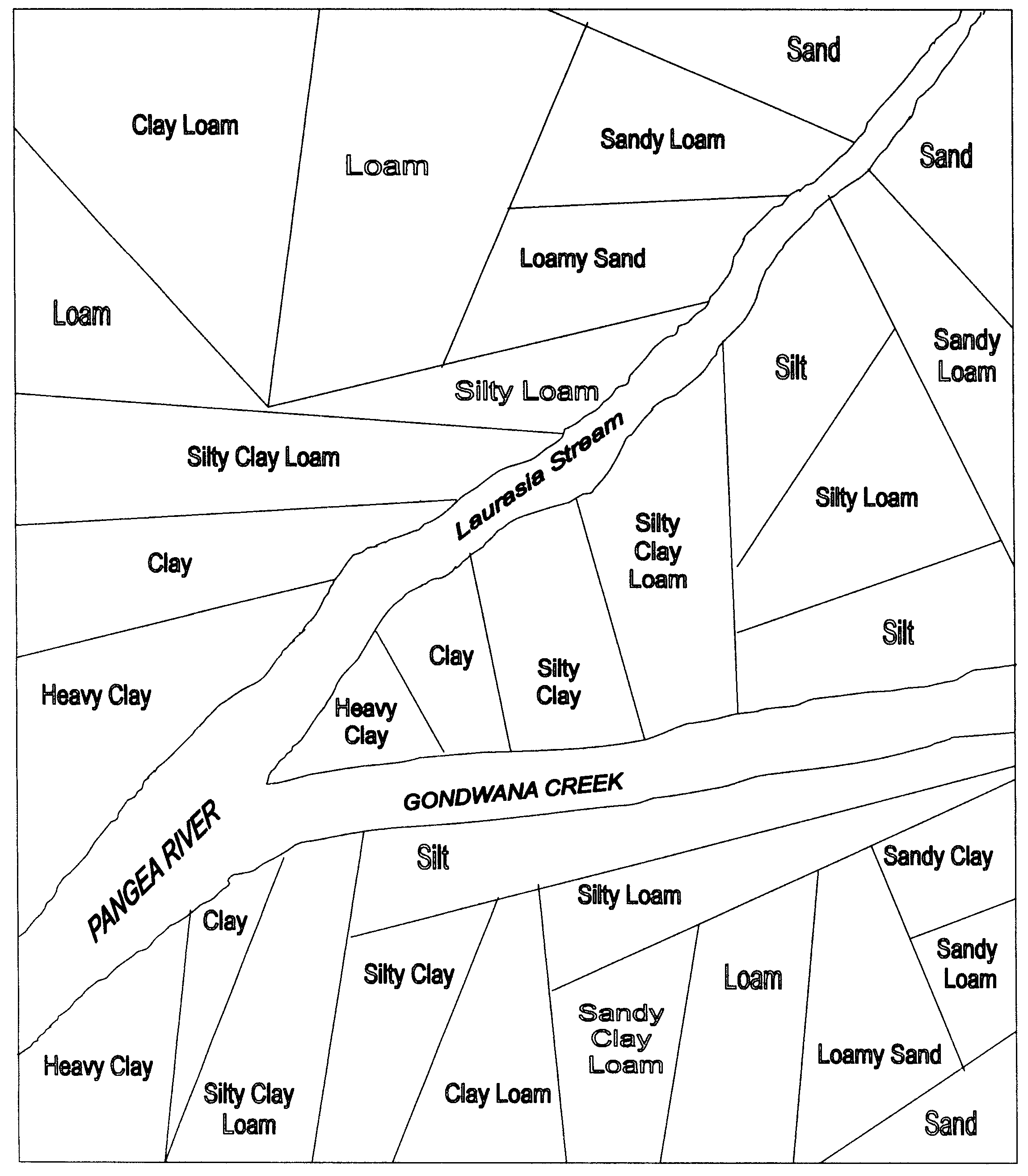
Unlike your Soil Particle Size Chart, which gives you a Worms-Eye View that is called a Cross Section, your Soil Type Map, gives you a Birds-Eye View of the situation, as if you were looking down at the ground from an airplane. This is called a Plan View and its the perspective that most land use planners like to use when deciding what to put where. This activity will give you some practice working in Plan View.
Principle #1 Zoning
One type of soil may have many potential uses that are in conflict with each other. For example, not everyone wants to build their new home right beside a large pig barn or factory. It is a good idea to create special Zones with clearly defined boundaries (e.g., natural landscape features like rivers) where only one kind of activity is allowed to take place. Using the different hatching techniques shown, indicate on your Soil Type Map where you want to create the following zones...
![]()
Keep in mind that Agricultural Uses generally require the most land area, but that Urban Uses have the highest tax rates! How do you put a value on Conservation Areas?
Principle #2 Green Spaces
Buffer Zones and Green Belts of different types of plants are good visual barriers to ugly land use activities and provide excellent natural barriers to pollution of surface water. They also allow wildlife to live relatively undisturbed by human activities, especially if they are well connected and close to each other. When assigning land uses on your Soil Type Map, always be on the look-out for good places to establish Conservation Areas.
Principle #3 Soil Type Suitability
You know from your experiments that not all soil types are suited for the same uses because of their ability to transport water and contaminants. Choose a different colour for each soil type and colour your Textural Triangle Chart. Match these colours to your Soil Type Map and Appropriate Soil Texture(s) in the chart below.
For example, you may choose Light Blue = Loam, Red = Heavy Clay, Yellow = Silty Clay Loam, etc.
Now draw in your own symbols or cut and paste the Land Use Symbols provided to indicate how you think the land on the map should be used.
|
Land Use |
Appropriate Soil Texture(s) |
|||||||
|
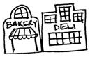
Urban Use: Business District (Shops, Office Buildings, Parking Lots) |
Heavy Clay |
Clay |
Sandy Clay |
Silty Clay |
||||
|
Urban Use: Housing Complex |
Heavy Clay |
Clay |
Sandy Clay |
Silty Clay |
||||
|
Urban Use: Sports Field |
Sand |
Loamy Sand |
Sandy Loam |
Sandy Clay Loam |
||||
|
Agricultural Use: Potato Crop |
Sand |
Loamy Sand |
Sandy Loam |
|||||
|
Agricultural Use: Corn Crop |
Loam |
Sandy Loam |
Clay Loam |
Silty Loam |
||||
|
Agricultural Use: Rice Crop |
Silt |
Silty Loam |
Silty Clay Loam |
Silty Clay |
||||
|
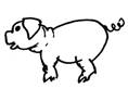
Agricultural Use: Livestock Barn |
Heavy Clay |
Clay |
Sandy Clay |
Silty Clay |
||||
|
Industrial Use: Garbage Dump or Landfill Site |
Heavy Clay |
Clay |
Silty Clay |
|||||
|
Industrial Use: Sand Pit |
Sand |
|||||||
|
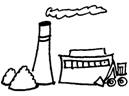
Industrial Use: Factory |
Heavy Clay |
Clay |
Sandy Clay |
Silty Clay |
||||
|
Other Use: Conservation Area |
All Soil Types |
|||||||
Handout: Land Use Symbols
Land Use Symbols
 GARBAGE DUMP |
 POTATO PATCH |
 CORN FIELD |
 RICE PADDY |
SAND PIT |
|
HOUSING COMPLEX |
LIVESTOCK BARN |
FACTORY |
 SPORTS FIELD |
BUSINESS DISTRICT |
 CONSERVATION AREA |
||||
|
CONSERVATION AREA |
||||
 CONSERVATION AREA |
||||
|
CONSERVATION AREA |
||||
Handout: Soil Texture Triangle
Handout: Soil Type Map
Terra Nova, Ontario
Handout: Soil Particle Size Chart
|
Soil Component |
Actual Size (mm) |
Simulated Material (e.g., Marbles, Rice, Paper) |
Worms-Eye View
(Draw what you see) |
Particle Size (e.g., Small Medium Large) |
Particle Shape (e.g., Round Irregular Flat) |
Pore Size (e.g., Large Medium Small) |
Pore Shape (e.g., Double- Pyramid Irregular Flat) |
Are the pores well connected? (Yes, No, Somewhat) |
|
Sand |
2.0 0.05 |
|
|
|
|
|
|
|
|
Silt |
0.05 - 0.002 |
|
|
|
|
|
|
|
|
Clay |
<0.002 |
|
|
|
|
|
|
|
Handout: Experimental Notes Water Transport
|
Soil Component |
Original Volume of Water Introduced Into Apparatus |
Dry Conditions |
Wet Conditions |
Observations |
||
|
Time Through Apparatus (seconds, minutes) |
Volume In Collection Flask (millilitres) |
Time Through Apparatus (seconds, minutes) |
Volume In Collection Flask (millilitres) |
|||
|
Sand |
400 ml |
|
|
|
|
|
|
Silt |
400 ml |
|
|
|
|
|
|
Clay |
400 ml |
|
|
|
|
|
Handout: Experimental Notes Contaminant Transport
|
Soil Component |
Contaminant |
|||||
|
Actual |
Bacteria and Large Biologic Organisms |
Particulates |
Viruses and Small Biologic Organisms |
Dissolved |
Non-water Soluble |
|
|
Simulated Material |
|
|
|
|
|
|
|
Observations (e.g., Was all of the contaminant transported through the apparatus? Did the contaminant appear to absorb onto the material?) |
||||||
|
Sand |
|
|
|
|
|
|
|
Silt |
|
|
|
|
|
|
|
Clay |
|
|
|
|
|
|
![]()

![]()